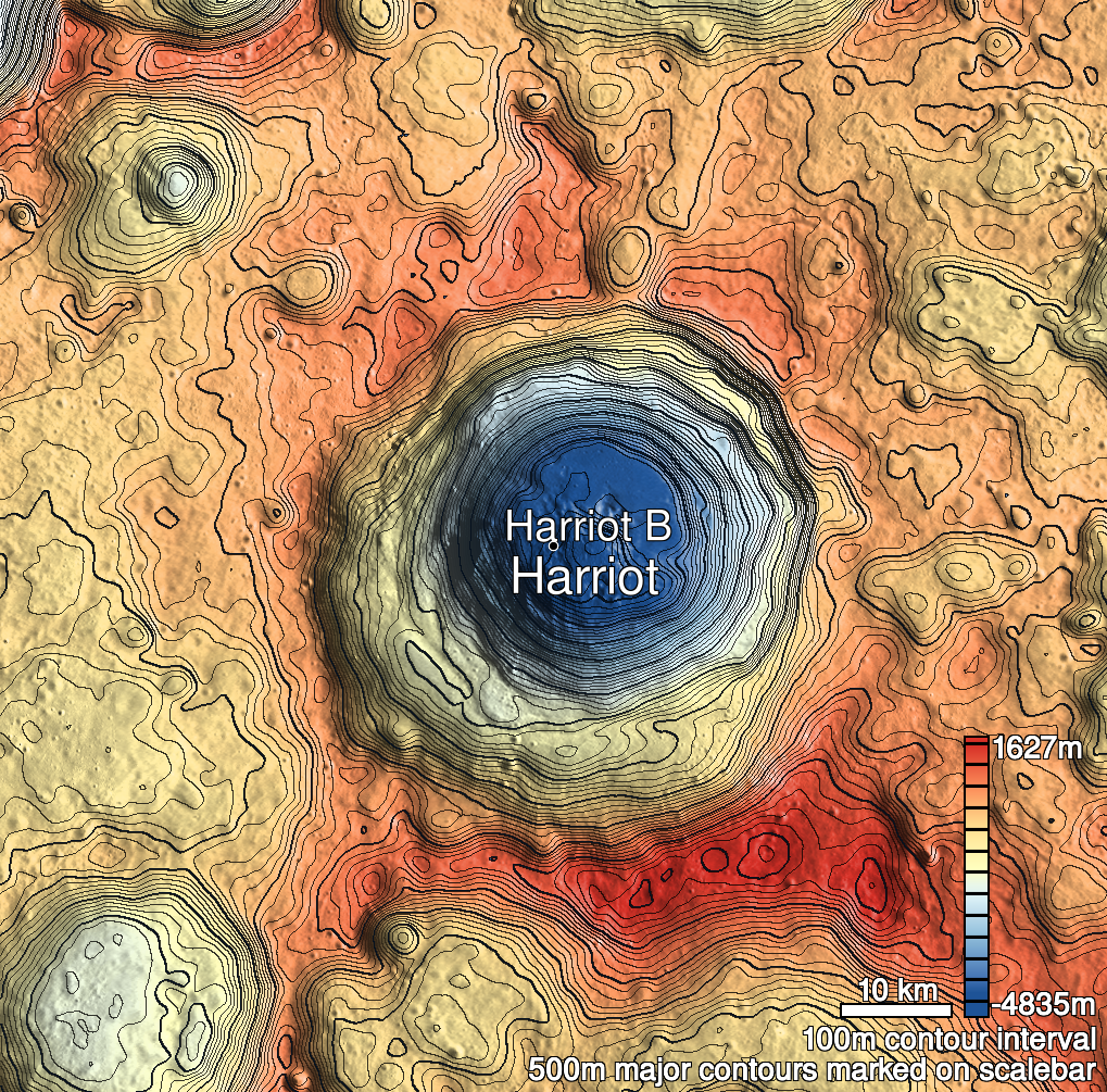
Pits Atlas: Harriot 1
| Impact Melt pit: Harriot | |
|---|---|
| Name | Harriot 1 |
| Lat. | 33.2933 |
| Long. | 114.2911 |
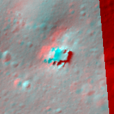
| Desc. | A wide, shallow pit, roughly square. The west wall is a smooth slope to the floor, and there seems to be a boulder pile in the NE corner that reaches the rim. No nearby collapses. |
| Types | |
| Terrain | Impact Melt |
| Host Feature | Harriot |
| Funnel Min. Diam. | 34 |
| Funnel Max. Diam. | 41 |
| Inner Min. Diam. | 25 |
| Inner Max. Diam. | 27 |
| Azimuth | 50 |
| Depth | 9.0 |
| Depth 1 | 12.1 |
| Depth 2 | 10.0 |
| Depth 3 | 4.5 |
| Best Stereo Left | M1227613833L |
| Best Stereo Right | M1227613833L |
| DTMs | |
| Clipping Width | 200 |
| Other IMGs | |
| Data Warning | Depth 3 is from top of funnel to west slope near what I thought was the floor, and very close to Depth 2. |
| Entrance Ramp | Y |
| Overhang | ? |
| Nearby Pits? | N |
| Nearby Fractures? | N |
| Nearby Depressions? | N |
| In Dome | N |
| Beside Dome | N |
| In Depression | N |
| Colinear Pits | N |
| Colinear Depressions | N |
| Colinear Fractures | N |
| Harriot 1 Shaded Relief | |
|---|---|
 |
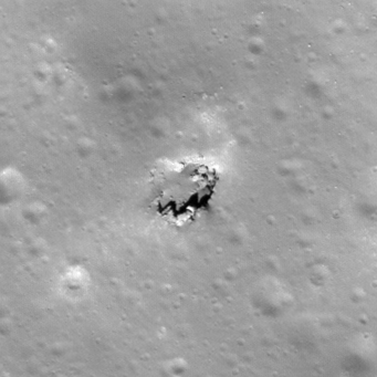
| M123826391L | |
|---|---|
 |
|
| Line | 12330 |
| Sample | 4266 |
| Inc. Angle | -32.79 |
| Emission Angle | 0.68 |
| Time | 12.56 |
| Resolution | 0.59 |
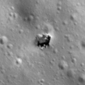
| M106123760R | |
|---|---|
 |
|
| Inc. Angle | -46.81 |
| Emission Angle | -0.18 |
| Time | 14.26 |
| Resolution | 1.65 |
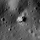
| M130904815R | |
|---|---|
 |
|
| Inc. Angle | 74.66 |
| Emission Angle | 1.18 |
| Time | 7.2 |
| Resolution | 0.89 |
| Harriot 1 Stereo |
|---|
 |