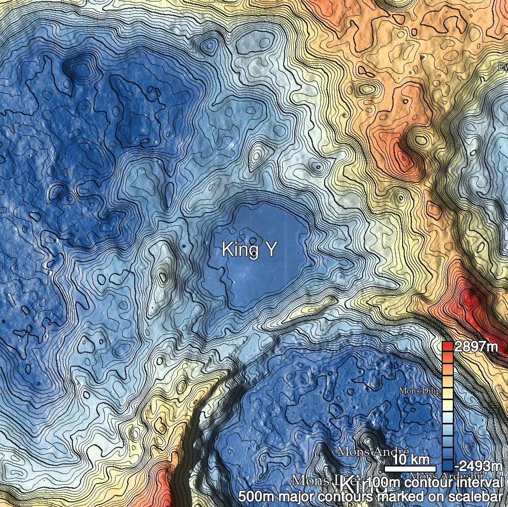
Pits Atlas: King 15a
| Impact Melt pit: King | |
|---|---|
| Name | King 15a |
| Lat. | 6.4782 |
| Long. | 119.7847 |
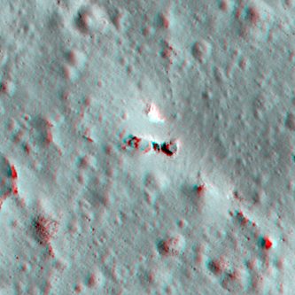
| Desc. | Western of a triplet of pits in a PRF. This pit is at the W edge of the PRF, and the SW rim is a ramp to the floor. King 15b is 9m E, separated from King 15a by two ~2m-wide ridges and an uncatalogued ~6x3x3m pit/collapse. No indications of a bridge-type connection between any of the pits. Other collapse features in the area are a sinuous collection of <5m probably pits joined by depressions ~75m WSW, a small collapse in the S side of the PRF ~40m SE, and sub-5m pits ~100m SE and ~110m SSW. |
| Types | |
| Terrain | Impact Melt |
| Host Feature | King |
| Funnel Min. Diam. | 15 |
| Funnel Max. Diam. | 19 |
| Inner Min. Diam. | 9 |
| Inner Max. Diam. | 13 |
| Azimuth | 100 |
| Depth | 4.0 |
| Depth 1 | 3.4 |
| Depth 2 | 4.0 |
| Depth 3 | 5.5 |
| Best Stereo Left | M136762839L |
| Best Stereo Right | M136762839L |
| DTMs | NAC_DTM_KINGCRATER3 |
| Clipping Width | 200 |
| Other IMGs | |
| Data Warning | |
| Entrance Ramp | Y |
| Overhang | N? |
| Nearby Pits? | Y |
| Nearby Fractures? | Y |
| Nearby Depressions? | Y |
| In Dome | Y |
| Beside Dome | Y |
| In Depression | N |
| Colinear Pits | Y |
| Colinear Depressions | Y? |
| Colinear Fractures | N |
| King 15a Shaded Relief | |
|---|---|
 |
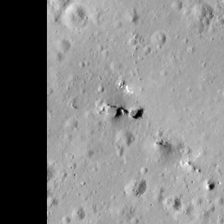
| M113168034L | |
|---|---|
 |
|
| Line | 23069 |
| Sample | 4942 |
| Inc. Angle | 47.46 |
| Emission Angle | -0.3 |
| Time | 8.87 |
| Resolution | 0.62 |
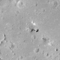
| M1135766659R | |
|---|---|
 |
|
| Inc. Angle | 28.94 |
| Emission Angle | 0.33 |
| Time | 10.13 |
| Resolution | 1.17 |
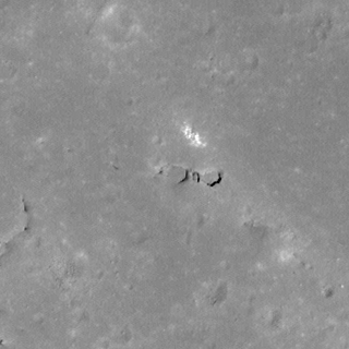
| M141478563R | |
|---|---|
 |
|
| Inc. Angle | 14.22 |
| Emission Angle | 1.66 |
| Time | 11.21 |
| Resolution | 0.61 |
| King 15a Stereo |
|---|
 |