Pits Atlas: King 15b
| Impact Melt pit: King | |
|---|---|
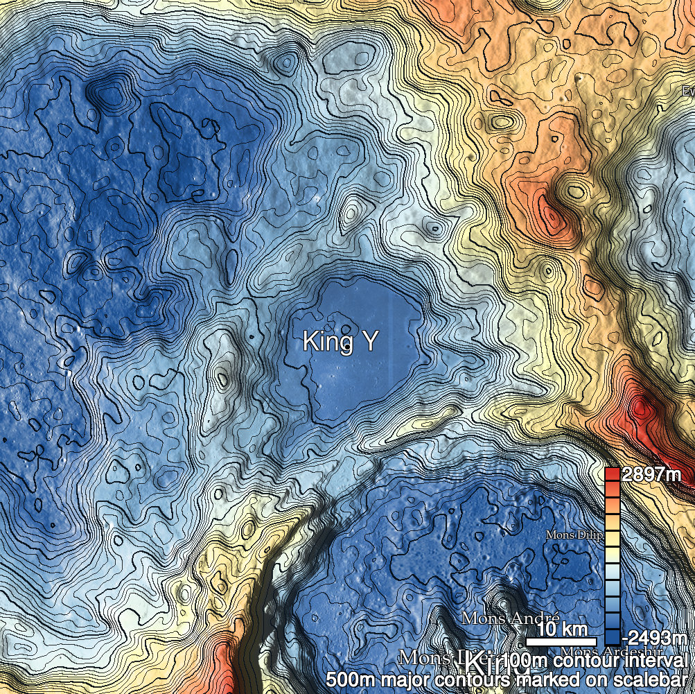
| Name | King 15b |
| Lat. | 6.4781 |
| Long. | 119.7853 |
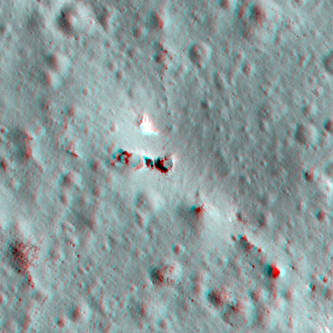
| Desc. | Eastern of a triplet of pits in a PRF. Near the middle of the PRF, no apparent entrance ramps, floor seems to be rough, although no visible boulders at 50cm/px. |
| Types | |
| Terrain | Impact Melt |
| Host Feature | King |
| Funnel Min. Diam. | 13 |
| Funnel Max. Diam. | 15 |
| Inner Min. Diam. | 7 |
| Inner Max. Diam. | 12 |
| Azimuth | 60 |
| Depth | 3.0 |
| Depth 1 | 4.4 |
| Depth 2 | 2.2 |
| Depth 3 | 3.4 |
| Best Stereo Left | M136762839L |
| Best Stereo Right | M136762839L |
| DTMs | NAC_DTM_KINGCRATER3 |
| Clipping Width | 200 |
| Other IMGs | |
| Data Warning | |
| Entrance Ramp | N |
| Overhang | N? |
| Nearby Pits? | Y |
| Nearby Fractures? | Y |
| Nearby Depressions? | Y |
| In Dome | Y |
| Beside Dome | N |
| In Depression | N |
| Colinear Pits | Y |
| Colinear Depressions | Y? |
| Colinear Fractures | N |
| King 15b Shaded Relief | |
|---|---|
 |
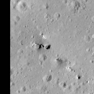
| M113168034L | |
|---|---|
 |
|
| Line | 23071 |
| Sample | 4909 |
| Inc. Angle | 47.46 |
| Emission Angle | -0.31 |
| Time | 8.87 |
| Resolution | 0.62 |
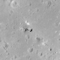
| M1135766659R | |
|---|---|
 |
|
| Inc. Angle | 28.94 |
| Emission Angle | 0.32 |
| Time | 10.13 |
| Resolution | 1.17 |
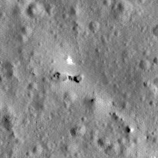
| M182745931L | |
|---|---|
 |
|
| Inc. Angle | -48.3 |
| Emission Angle | 1.86 |
| Time | 15.21 |
| Resolution | 1.27 |
| King 15b Stereo |
|---|
 |