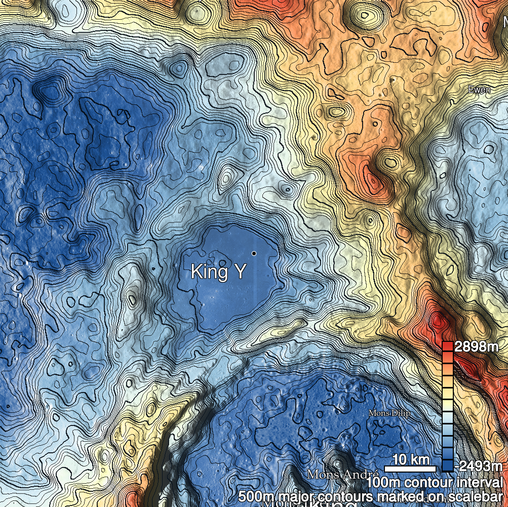
Pits Atlas: King 17
| Impact Melt pit: King | |
|---|---|
| Name | King 17 |
| Lat. | 6.6252 |
| Long. | 119.9847 |
| Desc. | Round pit in fairly flat terrain. Floor has a couple of boulders on W side; no ramps to surface. King 18 is ~140m ESE, and King 39 is ~170m N. There are a few other tiny pit-like features in the area. |
| Types | |
| Terrain | Impact Melt |
| Host Feature | King |
| Funnel Min. Diam. | 10 |
| Funnel Max. Diam. | 14 |
| Inner Min. Diam. | 7 |
| Inner Max. Diam. | 10 |
| Azimuth | 105 |
| Depth | 5.0 |
| Depth 1 | 4.7 |
| Depth 2 | 4.8 |
| Depth 3 | 4.9 |
| Best Stereo Left | M128509025R |
| Best Stereo Right | M128509025R |
| DTMs | NAC_DTM_KINGCRATER2 |
| Clipping Width | 200 |
| Other IMGs | |
| Data Warning | |
| Entrance Ramp | N |
| Overhang | ? |
| Nearby Pits? | Y |
| Nearby Fractures? | Y |
| Nearby Depressions? | Y |
| In Dome | N |
| Beside Dome | N |
| In Depression | N |
| Colinear Pits | N |
| Colinear Depressions | N |
| Colinear Fractures | N |
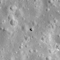
| King 17 Shaded Relief | |
|---|---|
 |
| M1120456952R | |
|---|---|
 |
|
| Line | 36545 |
| Sample | 2699 |
| Inc. Angle | 32.28 |
| Emission Angle | 1.31 |
| Time | 9.88 |
| Resolution | 1.17 |
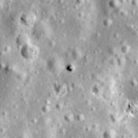
| M1131053889R | |
|---|---|
 |
|
| Inc. Angle | -27.68 |
| Emission Angle | -0.09 |
| Time | 13.77 |
| Resolution | 1.17 |
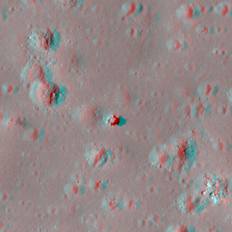
| M106088433R | |
|---|---|
 |
|
| Inc. Angle | -35.39 |
| Emission Angle | -2.03 |
| Time | 14.31 |
| Resolution | 1.29 |
| King 17 Stereo |
|---|
 |