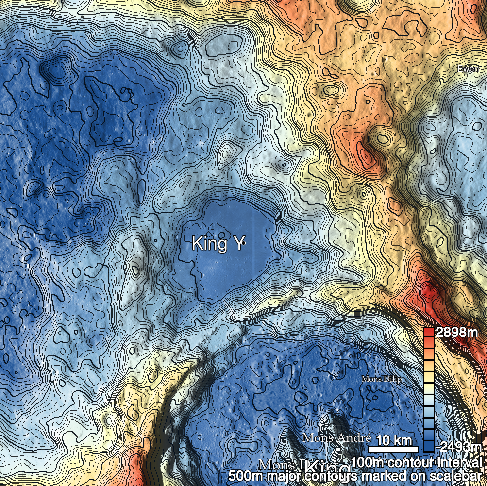
Pits Atlas: King 20a
| Impact Melt pit: King | |
|---|---|
| Name | King 20a |
| Lat. | 6.5098 |
| Long. | 119.9269 |
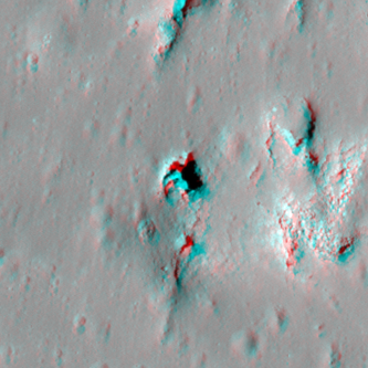
| Desc. | Southernmost and largest of a cluster of pits and other apparent collapse features. Pits are lettered from south to north (see individual entries for details). This pit is in the NW flank of a PRF. Additional features in the area are a shallow collapse at the E base of PRF containing 20a and 20b; a small shallow pit/fracture just S of 20a; a narrow collapse due E of 20d and due N of 20b; and a scattering of ~5m pits to the N and S. |
| Types | |
| Terrain | Impact Melt |
| Host Feature | King |
| Funnel Min. Diam. | 29 |
| Funnel Max. Diam. | 29 |
| Inner Min. Diam. | 12 |
| Inner Max. Diam. | 22 |
| Azimuth | 140 |
| Depth | 12.0 |
| Depth 1 | 11.5 |
| Depth 2 | 14.0 |
| Depth 3 | 9.5 |
| Best Stereo Left | M128509025R |
| Best Stereo Right | M128509025R |
| DTMs | NAC_DTM_KINGCRATER2 |
| Clipping Width | 200 |
| Other IMGs | M1164027461R, M108447638R |
| Data Warning | |
| Entrance Ramp | N |
| Overhang | ? |
| Nearby Pits? | Y |
| Nearby Fractures? | Y |
| Nearby Depressions? | Y |
| In Dome | Y |
| Beside Dome | N |
| In Depression | N |
| Colinear Pits | Y |
| Colinear Depressions | Y |
| Colinear Fractures | Y |
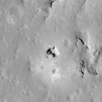
| King 20a Shaded Relief | |
|---|---|
 |
| M1131053889L | |
|---|---|
 |
|
| Line | 22492 |
| Sample | 3900 |
| Inc. Angle | -27.59 |
| Emission Angle | 0.93 |
| Time | 13.76 |
| Resolution | 1.17 |
| M1181692437R | |
|---|---|
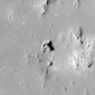 |
|
| Inc. Angle | 32.25 |
| Emission Angle | -0.15 |
| Time | 9.89 |
| Resolution | 1.23 |
| M141478563L | |
|---|---|
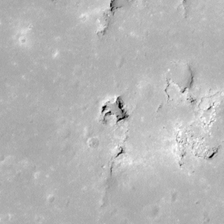 |
|
| Inc. Angle | 14.12 |
| Emission Angle | -2.48 |
| Time | 11.22 |
| Resolution | 0.62 |
| King 20a Stereo |
|---|
 |