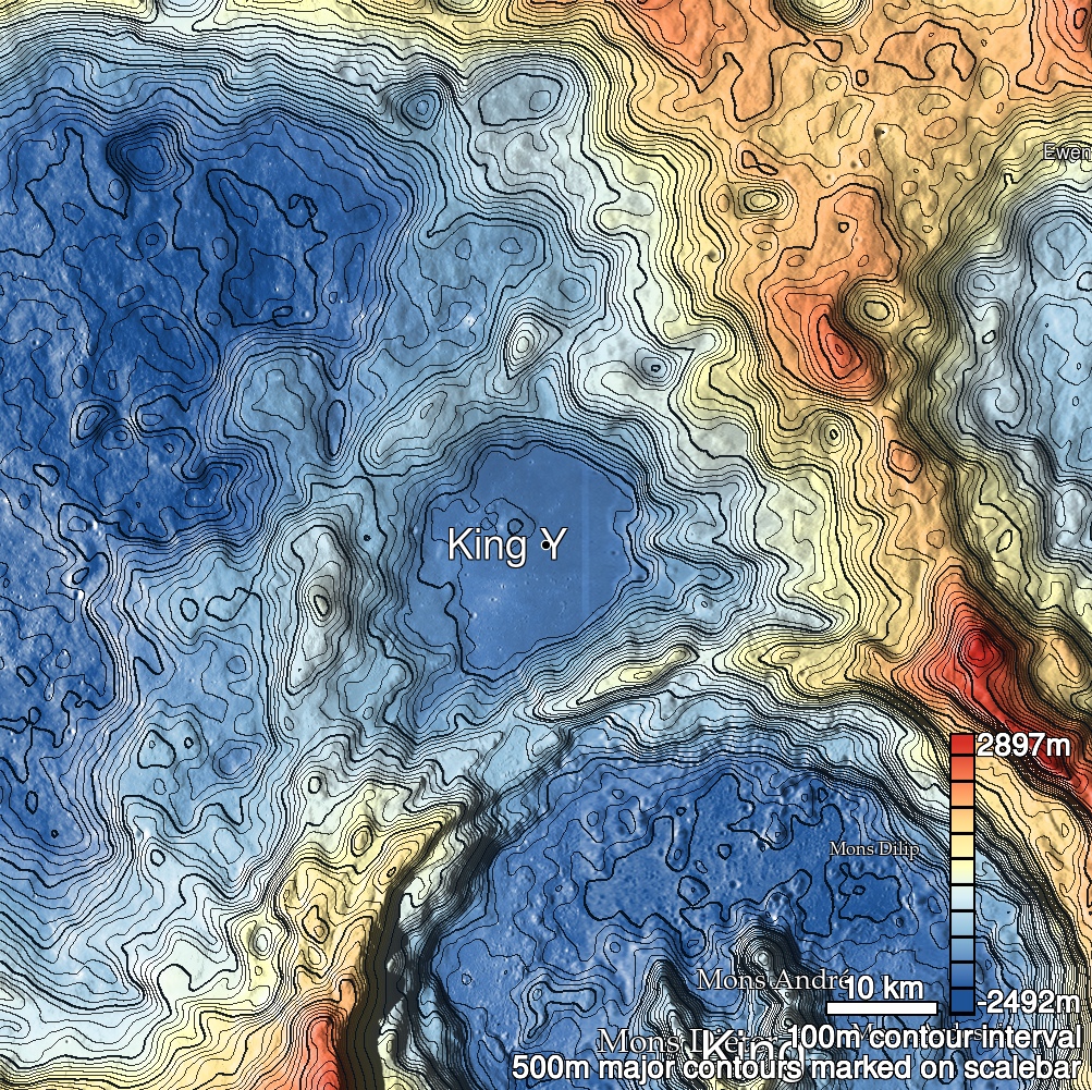
Pits Atlas: King 27
| Impact Melt pit: King | |
|---|---|
| Name | King 27 |
| Lat. | 6.5044 |
| Long. | 119.8719 |
| Desc. | Round pit at the SE edge of a PRF. The NW edge of the PRF (17m away) is collapsed, and there is an extensive fracture network to the S and E. There's some odd geometry on the S wall of the pit that is hard to parse. |
| Types | |
| Terrain | Impact Melt |
| Host Feature | King |
| Funnel Min. Diam. | 6 |
| Funnel Max. Diam. | 9 |
| Inner Min. Diam. | 4 |
| Inner Max. Diam. | 6 |
| Azimuth | 20 |
| Depth | 9.0 |
| Depth 1 | 8.7 |
| Depth 2 | 8.7 |
| Depth 3 | >9.0 |
| Best Stereo Left | M136762839R |
| Best Stereo Right | M136762839R |
| DTMs | NAC_DTM_KINGCRATER3 |
| Clipping Width | 200 |
| Other IMGs | |
| Data Warning | Floor is only visible in the three highest-Sun images, and M1164027461R is too high-Sun and low-resolution to use. |
| Entrance Ramp | N |
| Overhang | ? |
| Nearby Pits? | Y |
| Nearby Fractures? | Y |
| Nearby Depressions? | Y |
| In Dome | Y |
| Beside Dome | Y |
| In Depression | N? |
| Colinear Pits | N |
| Colinear Depressions | N |
| Colinear Fractures | Y |
| King 27 Shaded Relief | |
|---|---|
 |
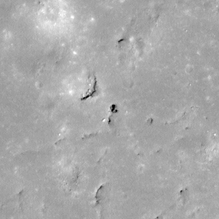
| M108447638L | |
|---|---|
 |
|
| Line | 24619 |
| Sample | 4860 |
| Inc. Angle | -11.06 |
| Emission Angle | 0.33 |
| Time | 12.52 |
| Resolution | 0.56 |
| M141478563L | |
|---|---|
 |
|
| Inc. Angle | 14.16 |
| Emission Angle | -0.88 |
| Time | 11.22 |
| Resolution | 0.62 |
| King 27 Stereo |
|---|
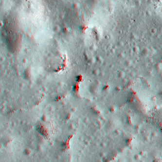 |