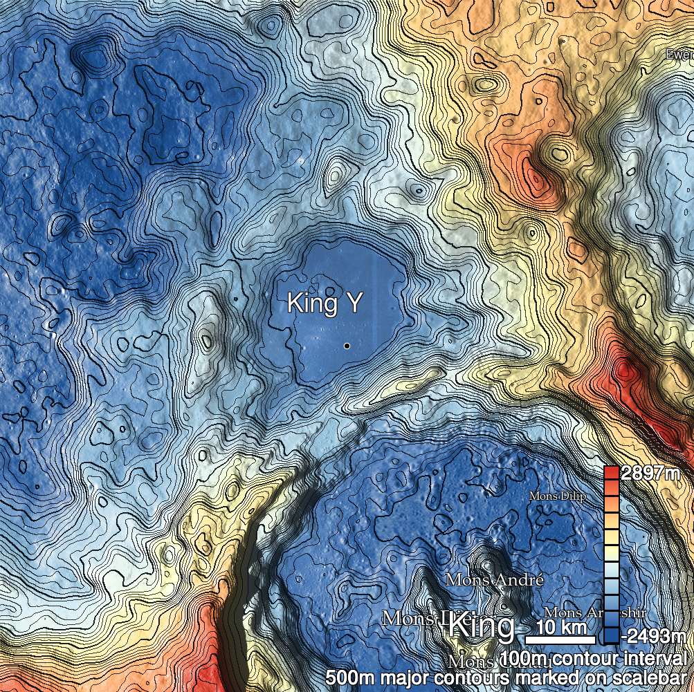
Pits Atlas: King 28
| Impact Melt pit: King | |
|---|---|
| Name | King 28 |
| Lat. | 6.3016 |
| Long. | 119.8593 |
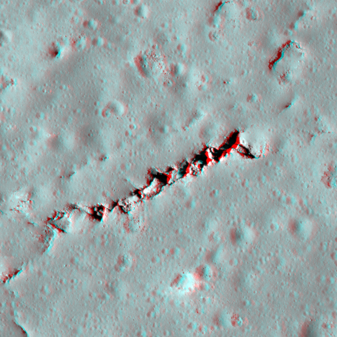
| Desc. | Large linear collapse feature- looks like two parallel fractures formed over a void and the ground between them dropped. Mostly filled with blocks and boulders. The NE end forms a ramp to the surface, and there are a few places with fairly deep openings (depth measurements are in one such 11x9m opening near the NE end). Several tiny depressions/pits parallel this feature ~40m N, and there are several other shallow collapses and depressions in the area that hint at a larger connected network of voids. |
| Types | |
| Terrain | Impact Melt |
| Host Feature | King |
| Funnel Min. Diam. | 20 |
| Funnel Max. Diam. | 223 |
| Inner Min. Diam. | 15 |
| Inner Max. Diam. | 156 |
| Azimuth | 60 |
| Depth | 22.0 |
| Depth 1 | 24.4 |
| Depth 2 | 26.0 |
| Depth 3 | 16.3 |
| Best Stereo Left | M136762839R |
| Best Stereo Right | M136762839R |
| DTMs | NAC_DTM_KINGCRATER3 |
| Clipping Width | 400 |
| Other IMGs | M1135766659L |
| Data Warning | |
| Entrance Ramp | Y |
| Overhang | ? |
| Nearby Pits? | Y |
| Nearby Fractures? | Y |
| Nearby Depressions? | Y |
| In Dome | N |
| Beside Dome | N |
| In Depression | N |
| Colinear Pits | N |
| Colinear Depressions | N |
| Colinear Fractures | Y |
| King 28 Shaded Relief | |
|---|---|
 |
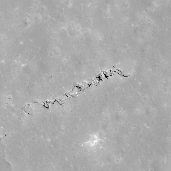
| M108447638L | |
|---|---|
 |
|
| Line | 35161 |
| Sample | 4194 |
| Inc. Angle | -10.91 |
| Emission Angle | 0.73 |
| Time | 12.52 |
| Resolution | 0.56 |
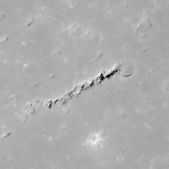
| M141478563L | |
|---|---|
 |
|
| Inc. Angle | 14.06 |
| Emission Angle | -0.46 |
| Time | 11.22 |
| Resolution | 0.62 |
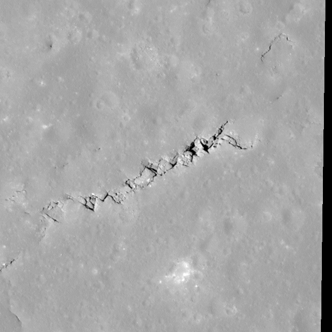
| M154453455R | |
|---|---|
 |
|
| Inc. Angle | -16.1 |
| Emission Angle | -2.43 |
| Time | 13.03 |
| Resolution | 0.6 |
| King 28 Stereo |
|---|
 |