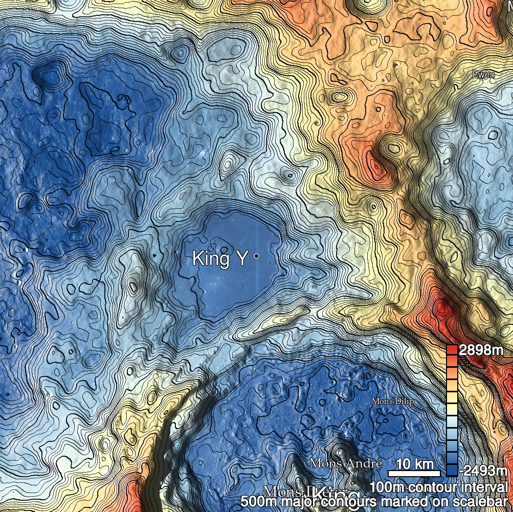
Pits Atlas: King 31
| Impact Melt pit: King | |
|---|---|
| Name | King 31 |
| Lat. | 6.5229 |
| Long. | 119.9879 |
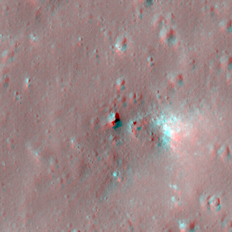
| Desc. | Round pit at the NW edge of a PRF. W (lower) wall might have a ramp to floor, but it's not certain. There are short fractures ~250m W and ~200m SW, and King 21 is ~165m S. |
| Types | |
| Terrain | Impact Melt |
| Host Feature | King |
| Funnel Min. Diam. | 12 |
| Funnel Max. Diam. | 12 |
| Inner Min. Diam. | 6 |
| Inner Max. Diam. | 9 |
| Azimuth | 25 |
| Depth | 5.0 |
| Depth 1 | 4.7 |
| Depth 2 | 4.2 |
| Depth 3 | 5.7 |
| Best Stereo Left | M128509025R |
| Best Stereo Right | M128509025R |
| DTMs | NAC_DTM_KINGCRATER2 |
| Clipping Width | 200 |
| Other IMGs | |
| Data Warning | |
| Entrance Ramp | N? |
| Overhang | ? |
| Nearby Pits? | Y |
| Nearby Fractures? | Y |
| Nearby Depressions? | Y |
| In Dome | N |
| Beside Dome | Y |
| In Depression | N |
| Colinear Pits | N |
| Colinear Depressions | Y |
| Colinear Fractures | Y |
| King 31 Shaded Relief | |
|---|---|
 |
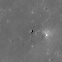
| M1120456952R | |
|---|---|
 |
|
| Line | 32552 |
| Sample | 2530 |
| Inc. Angle | 32.26 |
| Emission Angle | 1.21 |
| Time | 9.88 |
| Resolution | 1.17 |
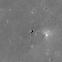
| M1135766659L | |
|---|---|
 |
|
| Inc. Angle | 28.76 |
| Emission Angle | -2.88 |
| Time | 10.14 |
| Resolution | 1.18 |
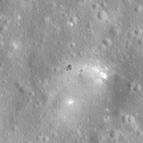
| M1131053889R | |
|---|---|
 |
|
| Inc. Angle | -27.65 |
| Emission Angle | -0.09 |
| Time | 13.77 |
| Resolution | 1.17 |
| King 31 Stereo |
|---|
 |