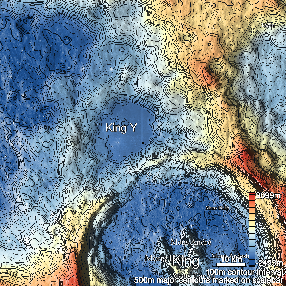
Pits Atlas: King 42
| Impact Melt pit: King | |
|---|---|
| Name | King 42 |
| Lat. | 6.3321 |
| Long. | 120.0066 |
| Desc. | Triangular pit just SW of a saddle between two PRFs. S corner appears to be ramp from rim to floor, and there is a slight depression running ~100m further to the SE. W wall appears very steeply sloped (>80 degrees?), not quite vertical. King 34a is ~290m WNW, and there are several small collapse features running NW-SE to the E. |
| Types | |
| Terrain | Impact Melt |
| Host Feature | King |
| Funnel Min. Diam. | 16 |
| Funnel Max. Diam. | 30 |
| Inner Min. Diam. | 10 |
| Inner Max. Diam. | 16 |
| Azimuth | 145 |
| Depth | 6.0 |
| Depth 1 | 7.8 |
| Depth 2 | 4.8 |
| Depth 3 | 4.9 |
| Best Stereo Left | M103732241R |
| Best Stereo Right | M103732241R |
| DTMs | NAC_DTM_KINGCRATER2 |
| Clipping Width | 200 |
| Other IMGs | |
| Data Warning | |
| Entrance Ramp | Y |
| Overhang | ? |
| Nearby Pits? | Y |
| Nearby Fractures? | N |
| Nearby Depressions? | Y |
| In Dome | N |
| Beside Dome | Y |
| In Depression | Y |
| Colinear Pits | N |
| Colinear Depressions | Y |
| Colinear Fractures | N |
| King 42 Shaded Relief | |
|---|---|
 |
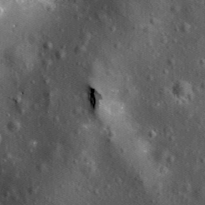
| M1120456952R | |
|---|---|
 |
|
| Line | 25137 |
| Sample | 1879 |
| Inc. Angle | 32.21 |
| Emission Angle | 0.81 |
| Time | 9.88 |
| Resolution | 1.17 |
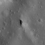
| M1131053889R | |
|---|---|
 |
|
| Inc. Angle | -27.62 |
| Emission Angle | -0.24 |
| Time | 13.77 |
| Resolution | 1.17 |
| M106088433R | |
|---|---|
 |
|
| Inc. Angle | -35.36 |
| Emission Angle | -2.35 |
| Time | 14.31 |
| Resolution | 1.29 |
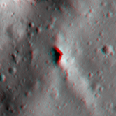
| King 42 Stereo |
|---|
 |