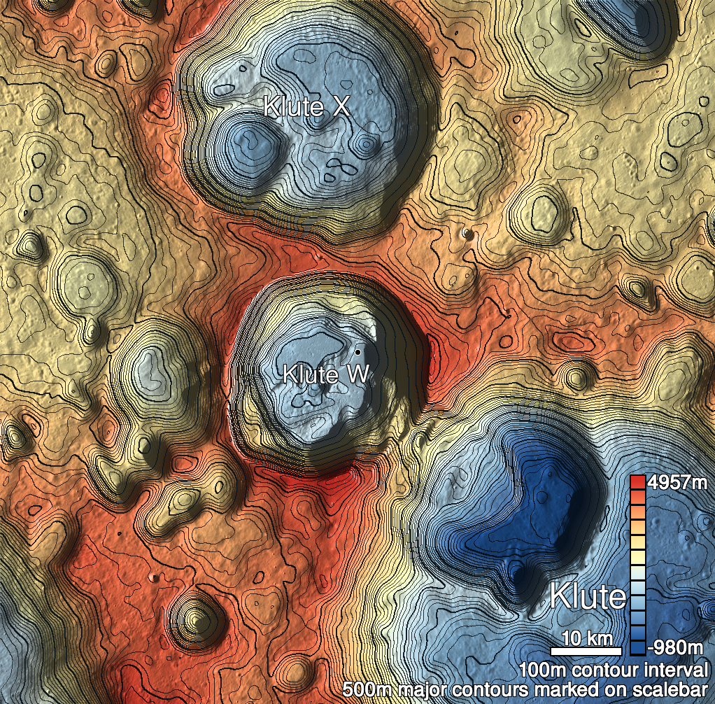
Pits Atlas: Klute W 1
| Impact Melt pit: Klute W | |
|---|---|
| Name | Klute W 1 |
| Lat. | 38.086 |
| Long. | 216.885 |
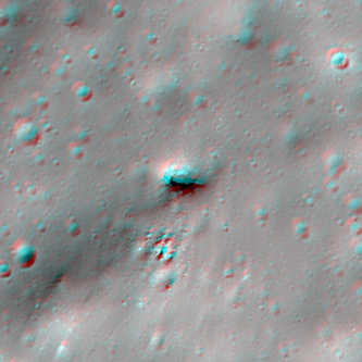
| Desc. | An elliptical pit with fairly pronounced funnel. A slope in the NE appears to reach the surrounding surface with no wall. There is an edge of a shadow visible in the slewed image M143194361L that indicates a slight (~1-2m) overhang with no illuminated back wall. Possible fracture with collapses starting ~100m north, possible round-bottomed linear depression ~200m east. |
| Types | |
| Terrain | Impact Melt |
| Host Feature | Klute W |
| Funnel Min. Diam. | 19 |
| Funnel Max. Diam. | 25 |
| Inner Min. Diam. | 10 |
| Inner Max. Diam. | 16 |
| Azimuth | 100 |
| Depth | 7.0 |
| Depth 1 | 6.0 |
| Depth 2 | 6.6 |
| Depth 3 | 7.5 |
| Best Stereo Left | M143201144L |
| Best Stereo Right | M143201144L |
| DTMs | |
| Clipping Width | 200 |
| Other IMGs | |
| Data Warning | |
| Entrance Ramp | Y? |
| Overhang | Y? |
| Nearby Pits? | N |
| Nearby Fractures? | Y? |
| Nearby Depressions? | Y |
| In Dome | Y |
| Beside Dome | Y |
| In Depression | N |
| Colinear Pits | N |
| Colinear Depressions | N? |
| Colinear Fractures | N? |
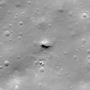
| Klute W 1 Shaded Relief | |
|---|---|
 |
| M140840176R | |
|---|---|
 |
|
| Line | 12918 |
| Sample | 2500 |
| Inc. Angle | 39.85 |
| Emission Angle | 1.15 |
| Time | 11.67 |
| Resolution | 0.62 |
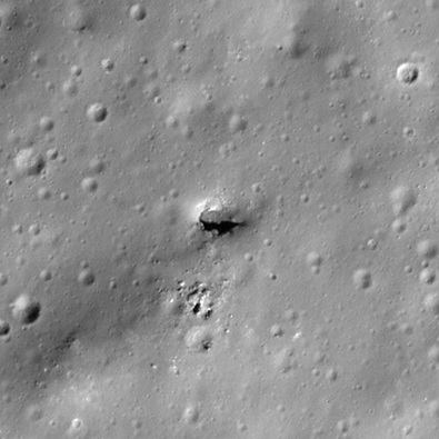
| M127871750L | |
|---|---|
 |
|
| Inc. Angle | 50.83 |
| Emission Angle | -2.52 |
| Time | 9.45 |
| Resolution | 0.47 |
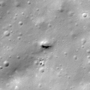
| M1119832662L | |
|---|---|
 |
|
| Inc. Angle | 42.96 |
| Emission Angle | -2.15 |
| Time | 10.45 |
| Resolution | 1.41 |
| Klute W 1 Stereo |
|---|
 |