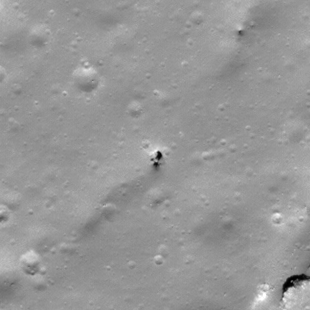
Pits Atlas: Klute W 4
| Impact Melt pit: Klute W | |
|---|---|
| Name | Klute W 4 |
| Lat. | 37.8581 |
| Long. | 216.8911 |
| Desc. | An elliptical pit at the north end of a ~60m long linear depression. Another ~60m segment start ~70 NE of the pit's segment, in line with that segment, ending when it runs into a small rise. There is another ~150m long linear depression, with some cliffs along it, ~100m to the SE. There appears to be a small boulder filling much of the south end of the pit. A slewed image (M171488353L) may be showing a few meters of overhang to the west. |
| Types | |
| Terrain | Impact Melt |
| Host Feature | Klute W |
| Funnel Min. Diam. | 12 |
| Funnel Max. Diam. | 16 |
| Inner Min. Diam. | 5 |
| Inner Max. Diam. | 6 |
| Azimuth | 10 |
| Depth | >8.0 |
| Depth 1 | >7.0 |
| Depth 2 | >5.0 |
| Depth 3 | >7.0 |
| Best Stereo Left | M143201144L |
| Best Stereo Right | M143201144L |
| DTMs | |
| Clipping Width | 200 |
| Other IMGs | |
| Data Warning | There seems to be a lit floor at 4.2 m depth in M140840176R, but the shadow edge does not agree with the sun direction. If it is a floor, and not wall, then the depth is ~4m, but there is a deeper section. |
| Entrance Ramp | N |
| Overhang | Y? |
| Nearby Pits? | N? |
| Nearby Fractures? | N |
| Nearby Depressions? | Y |
| In Dome | N |
| Beside Dome | N |
| In Depression | Y |
| Colinear Pits | N |
| Colinear Depressions | N? |
| Colinear Fractures | N |
| Klute W 4 Shaded Relief | |
|---|---|
 |
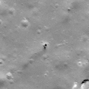
| M140840176R | |
|---|---|
 |
|
| Line | 23163 |
| Sample | 2316 |
| Inc. Angle | 39.63 |
| Emission Angle | 1.04 |
| Time | 11.67 |
| Resolution | 0.62 |
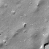
| M1148101020L | |
|---|---|
 |
|
| Inc. Angle | -37.05 |
| Emission Angle | 3.06 |
| Time | 12.38 |
| Resolution | 1.49 |
| M1135119263R | |
|---|---|
 |
|
| Inc. Angle | 43.94 |
| Emission Angle | 1.38 |
| Time | 10.5 |
| Resolution | 1.58 |
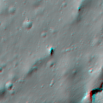
| Klute W 4 Stereo |
|---|
 |