Pits Atlas: Lalande 1
| Impact Melt pit: Lalande | |
|---|---|
| Name | Lalande 1 |
| Lat. | -4.4579 |
| Long. | 351.4667 |
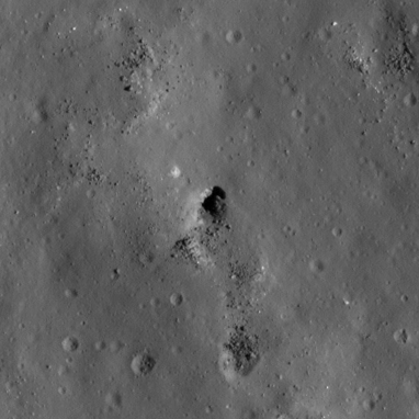
| Desc. | A semicircular collapse that seems to be mostly funnel. The east wall is a cliff, other walls are just slopes. There is a pair of straight parallel fractures/depressions ~280m SW, and a small linear pit(?) ~280m NW. |
| Types | |
| Terrain | Impact Melt |
| Host Feature | Lalande |
| Funnel Min. Diam. | 15 |
| Funnel Max. Diam. | 21 |
| Inner Min. Diam. | N/A |
| Inner Max. Diam. | 7 |
| Azimuth | 40 |
| Depth | 8.0 |
| Depth 1 | 8.5 |
| Depth 2 | 7.8 |
| Depth 3 | >4.0 |
| Best Stereo Left | M172975608L |
| Best Stereo Right | M172975608L |
| DTMs | |
| Clipping Width | 200 |
| Other IMGs | |
| Data Warning | Depth 3 is to half-way up the funnel; Depth 2 is a ~3px shadow. Stereo is accidental and probably only works for manual viewing. |
| Entrance Ramp | Y |
| Overhang | ? |
| Nearby Pits? | N |
| Nearby Fractures? | Y |
| Nearby Depressions? | Y |
| In Dome | N? |
| Beside Dome | Y |
| In Depression | N |
| Colinear Pits | N |
| Colinear Depressions | N |
| Colinear Fractures | N |
| Lalande 1 Shaded Relief | |
|---|---|
 |
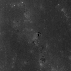
| M172975608L | |
|---|---|
 |
|
| Line | 22312 |
| Sample | 1550 |
| Inc. Angle | 16.36 |
| Emission Angle | -2.27 |
| Time | 10.93 |
| Resolution | 0.47 |
| M1118936862R | |
|---|---|
 |
|
| Inc. Angle | 15.84 |
| Emission Angle | 0.74 |
| Time | 11.01 |
| Resolution | 0.96 |
| M114009947L | |
|---|---|
 |
|
| Inc. Angle | 56.61 |
| Emission Angle | -0.8 |
| Time | 8.23 |
| Resolution | 0.5 |
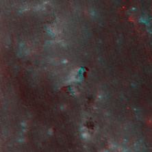
| Lalande 1 Stereo |
|---|
 |