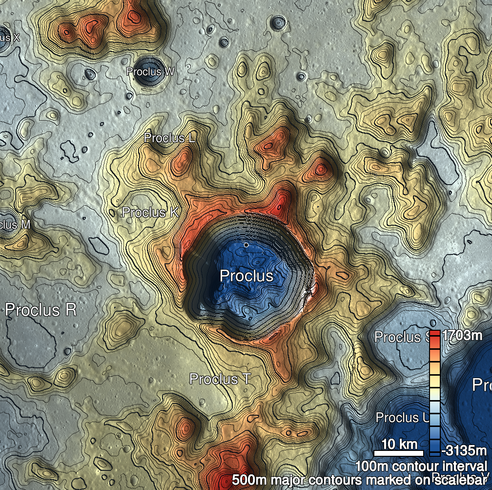
Pits Atlas: Proclus 1a
| Impact Melt pit: Proclus | |
|---|---|
| Name | Proclus 1a |
| Lat. | 16.2972 |
| Long. | 46.8941 |
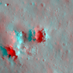
| Desc. | NE (and more clearly-defined) of a pair of pits ~65m apart. There is a ridge of rock (perhaps a half-buried boulder?), ~30m long, situated between them, and a series of subtle depressions loops around that rock to the NW. This pit has a few 2-8m boulders on the floor. A slewed image towards the east wall does not reveal any significant overhang, but that is the far wall from Proclus 1b and the other adjacent depressions. There is a shallow depression/cliff/fracture thing ~150m to the SE. |
| Types | |
| Terrain | Impact Melt |
| Host Feature | Proclus |
| Funnel Min. Diam. | 32 |
| Funnel Max. Diam. | 40 |
| Inner Min. Diam. | 18 |
| Inner Max. Diam. | 33 |
| Azimuth | 135 |
| Depth | 11.0 |
| Depth 1 | 10.7 |
| Depth 2 | 9.1 |
| Depth 3 | 12.4 |
| Best Stereo Left | M1175112574L |
| Best Stereo Right | M1175112574L |
| DTMs | |
| Clipping Width | 200 |
| Other IMGs | |
| Data Warning | Depth 3 may be high, due to combinations of high Sun and low resolution. |
| Entrance Ramp | N |
| Overhang | N? |
| Nearby Pits? | Y |
| Nearby Fractures? | N |
| Nearby Depressions? | Y |
| In Dome | N |
| Beside Dome | N |
| In Depression | N |
| Colinear Pits | N |
| Colinear Depressions | N |
| Colinear Fractures | N |
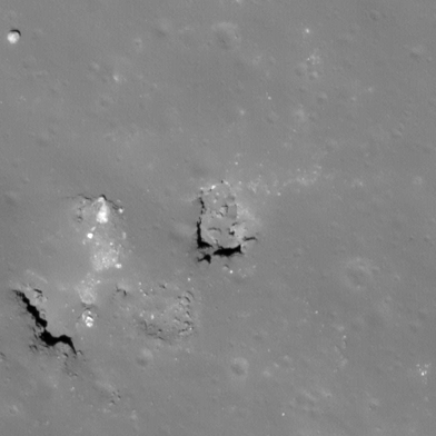
| Proclus 1a Shaded Relief | |
|---|---|
 |
| M139598775R | |
|---|---|
 |
|
| Line | 11581 |
| Sample | 1926 |
| Inc. Angle | -20.4 |
| Emission Angle | -0.8 |
| Time | 12.67 |
| Resolution | 0.47 |
| M1175105466L | |
|---|---|
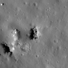 |
|
| Inc. Angle | -49.07 |
| Emission Angle | 1.75 |
| Time | 15.17 |
| Resolution | 1.15 |
| M187935731R | |
|---|---|
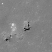 |
|
| Inc. Angle | 20.04 |
| Emission Angle | 1.46 |
| Time | 11.1 |
| Resolution | 1.29 |
| Proclus 1a Stereo |
|---|
 |