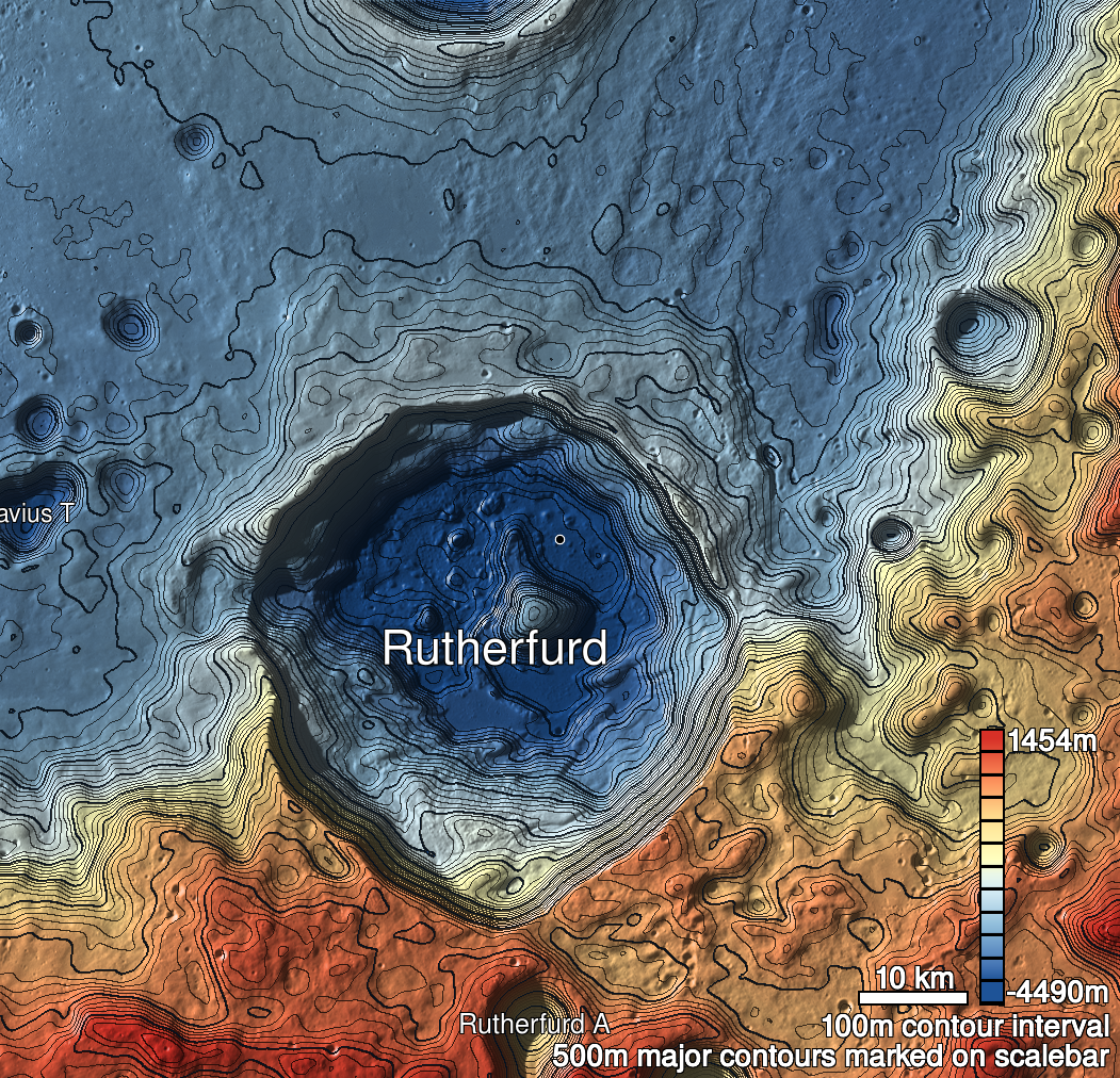
Pits Atlas: Rutherfurd 1a
| Impact Melt pit: Rutherfurd | |
|---|---|
| Name | Rutherfurd 1a |
| Lat. | -60.7788 |
| Long. | 348.1876 |
| Desc. | Larger of a pair of adjacent pits. Roughly square, with walls oriented ~45 degrees away from a line drawn through the pair of pits. Has a clear floor, appears to have a slope running from south corner to floor, maybe traversable. May be in a very subtle depression that is aligned with the pair of pits, but I think that's an optical illusion. ~300m ENE roughly along the line of the pits is another cliff/depression/collapse (Rutherfurd 3). |
| Types | |
| Terrain | Impact Melt |
| Host Feature | Rutherfurd |
| Funnel Min. Diam. | 17 |
| Funnel Max. Diam. | 18 |
| Inner Min. Diam. | 13 |
| Inner Max. Diam. | 14 |
| Azimuth | 70 |
| Depth | 5.0 |
| Depth 1 | 5.6 |
| Depth 2 | 4.7 |
| Depth 3 | >3.0 |
| Best Stereo Left | |
| Best Stereo Right | |
| DTMs | |
| Clipping Width | 200 |
| Other IMGs | |
| Data Warning | M1361100396L, M13202480613R |
| Entrance Ramp | Y? |
| Overhang | ? |
| Nearby Pits? | Y |
| Nearby Fractures? | N |
| Nearby Depressions? | Y |
| In Dome | N |
| Beside Dome | N? |
| In Depression | N |
| Colinear Pits | Y |
| Colinear Depressions | Y |
| Colinear Fractures | N |
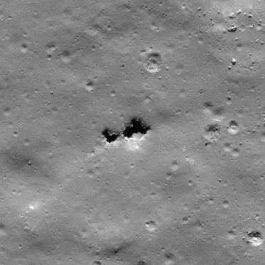
| Rutherfurd 1a Shaded Relief | |
|---|---|
 |
| M109305653L | |
|---|---|
 |
|
| Line | 5001 |
| Sample | 4150 |
| Inc. Angle | 59.32 |
| Emission Angle | -0.75 |
| Time | 11.8 |
| Resolution | 0.53 |
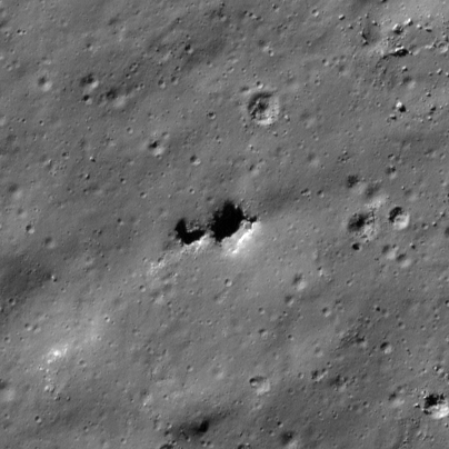
| M168287020R | |
|---|---|
 |
|
| Inc. Angle | -66.14 |
| Emission Angle | -1.73 |
| Time | 14.56 |
| Resolution | 0.44 |
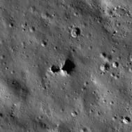
| M114024557R | |
|---|---|
 |
|
| Inc. Angle | 73.87 |
| Emission Angle | 2.45 |
| Time | 8.15 |
| Resolution | 0.79 |