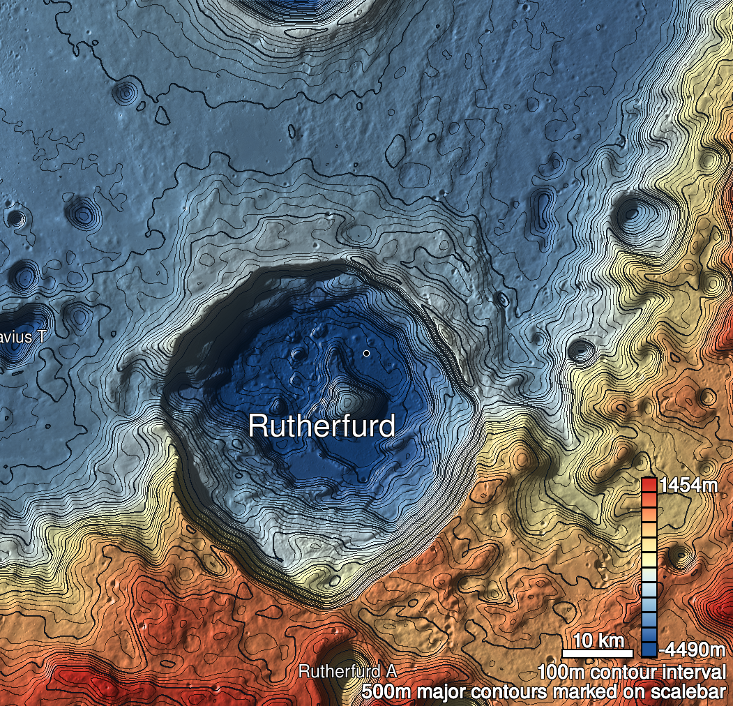
Pits Atlas: Rutherfurd 3
| Uncertain, Impact Melt pit: Rutherfurd | |
|---|---|
| Name | Rutherfurd 3 |
| Lat. | -60.7751 |
| Long. | 348.2076 |
| Desc. | Collapse ~300m ENE of Rutherfurd 1a/b, roughly in line with those two pits. Only north wall is vertical (and maybe a few meters of SE wall), others are slopes. |
| Types | Uncertain |
| Terrain | Impact Melt |
| Host Feature | Rutherfurd |
| Funnel Min. Diam. | 18 |
| Funnel Max. Diam. | 31 |
| Inner Min. Diam. | 8 |
| Inner Max. Diam. | 18 |
| Azimuth | 70 |
| Depth | 3.0 |
| Depth 1 | 3.9 |
| Depth 2 | 3.3 |
| Depth 3 | 3.5 |
| Best Stereo Left | |
| Best Stereo Right | |
| DTMs | |
| Clipping Width | 200 |
| Other IMGs | |
| Data Warning | M1361100396L, M13202480613R |
| Entrance Ramp | Y |
| Overhang | ? |
| Nearby Pits? | Y |
| Nearby Fractures? | N |
| Nearby Depressions? | Y |
| In Dome | N |
| Beside Dome | N |
| In Depression | N |
| Colinear Pits | Y |
| Colinear Depressions | N |
| Colinear Fractures | N |
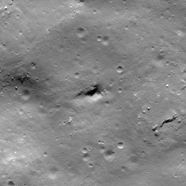
| Rutherfurd 3 Shaded Relief | |
|---|---|
 |
| M109305653L | |
|---|---|
 |
|
| Line | 4791 |
| Sample | 3587 |
| Inc. Angle | 59.31 |
| Emission Angle | -1.08 |
| Time | 11.8 |
| Resolution | 0.53 |
| M168287020R | |
|---|---|
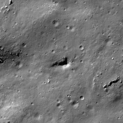 |
|
| Inc. Angle | -66.14 |
| Emission Angle | -2.12 |
| Time | 14.56 |
| Resolution | 0.44 |
| M114024557R | |
|---|---|
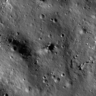 |
|
| Inc. Angle | 73.86 |
| Emission Angle | 2.13 |
| Time | 8.15 |
| Resolution | 0.79 |