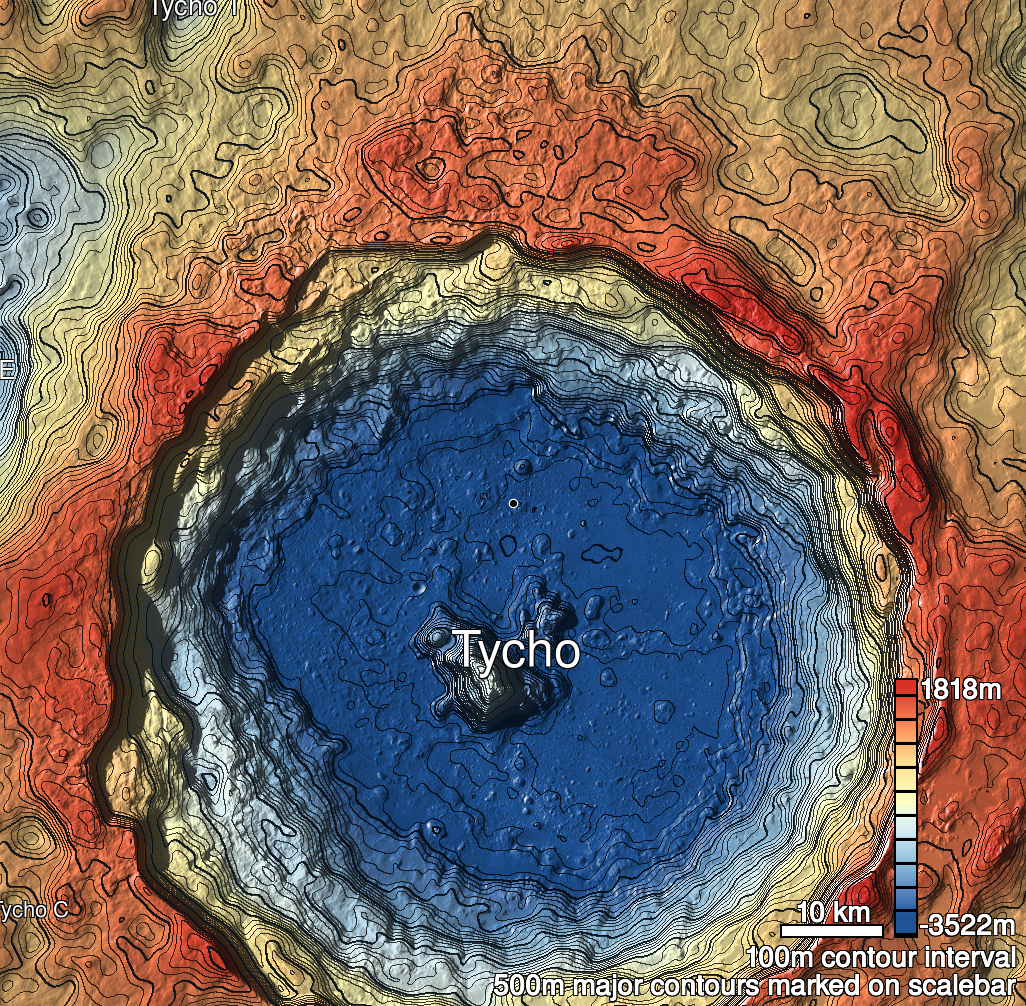
Pits Atlas: Tycho 8
| Impact Melt pit: Tycho | |
|---|---|
| Name | Tycho 8 |
| Lat. | -42.7882 |
| Long. | 348.7741 |
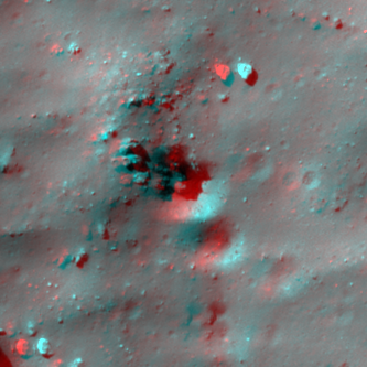
| Desc. | Large funnel at the base of a PRF, with vertical walls on the N and W sides part-way down the funnel (there appears to be a gap between N and W walls). Cannot tell if there is much actual "pit" to this feature. There is a depression with similarly steep walls to the funnel adjacent to the SE, and a string of subtle depressions running ~100m S from there. There is a wide, shallow collapse of some sort ~200m N. |
| Types | |
| Terrain | Impact Melt |
| Host Feature | Tycho |
| Funnel Min. Diam. | 37 |
| Funnel Max. Diam. | 42 |
| Inner Min. Diam. | 8 |
| Inner Max. Diam. | 8 |
| Azimuth | 135 |
| Depth | 10.0 |
| Depth 1 | >10.0 |
| Depth 2 | 13.3 |
| Depth 3 | 7.2 |
| Best Stereo Left | M1267233917R |
| Best Stereo Right | M1267233917R |
| DTMs | |
| Clipping Width | 200 |
| Other IMGs | |
| Data Warning | No high-Sun images are non-slewed. Depths 2 and 3 are measured looking with the Sun at a slew angle of 7-8 degrees, and so are likely too low. Depth 1 is measured from top of funnel to above the W wall. Depth 2 is from N wall, Depth 3 is from W wall. |
| Entrance Ramp | Y? |
| Overhang | ? |
| Nearby Pits? | N? |
| Nearby Fractures? | N |
| Nearby Depressions? | Y |
| In Dome | Y |
| Beside Dome | Y |
| In Depression | N |
| Colinear Pits | N |
| Colinear Depressions | Y |
| Colinear Fractures | N |
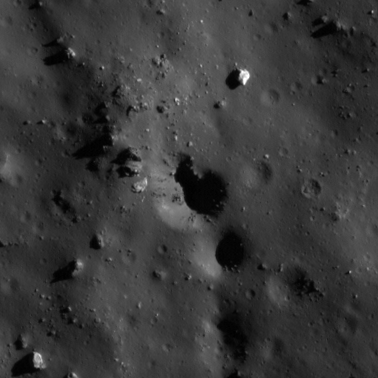
| Tycho 8 Shaded Relief | |
|---|---|
 |
| M114024246R | |
|---|---|
 |
|
| Line | 2109 |
| Sample | 1574 |
| Inc. Angle | 65.76 |
| Emission Angle | 0.59 |
| Time | 8.18 |
| Resolution | 0.51 |
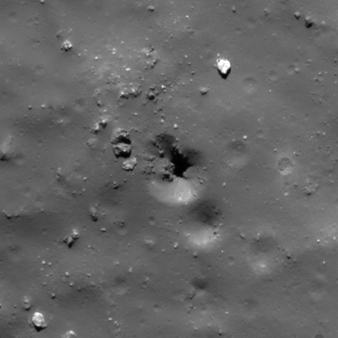
| M124646397R | |
|---|---|
 |
|
| Inc. Angle | 44.34 |
| Emission Angle | 7.19 |
| Time | 11.89 |
| Resolution | 0.51 |
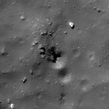
| M122291425R | |
|---|---|
 |
|
| Inc. Angle | -49.99 |
| Emission Angle | -8.48 |
| Time | 13.75 |
| Resolution | 0.52 |
| Tycho 8 Stereo |
|---|
 |