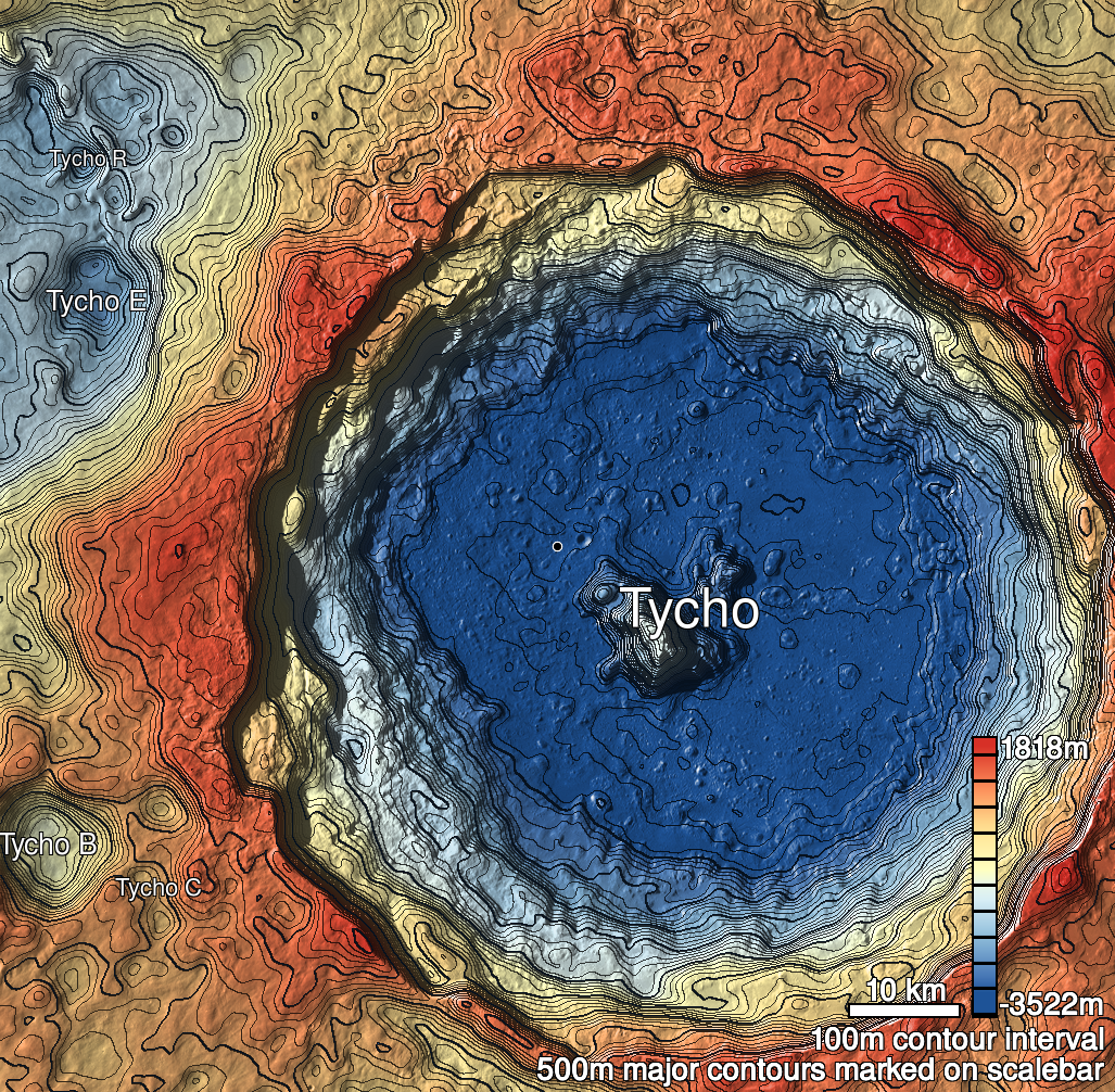
Pits Atlas: Tycho 17a
| Impact Melt pit: Tycho | |
|---|---|
| Name | Tycho 17a |
| Lat. | -43.0855 |
| Long. | 348.2422 |
| Desc. | Southern of two large bowl-shaped pits in a hill. 17a is at the peak, 17b is on the northeastern flank (150m N). There is a ~N-S-trending depression to the west. The SW wall of this pit is a ramp from ~surface to floor; the other walls appear uncollapsed. The floor is covered in 1-5m boulders. |
| Types | |
| Terrain | Impact Melt |
| Host Feature | Tycho |
| Funnel Min. Diam. | 61 |
| Funnel Max. Diam. | 86 |
| Inner Min. Diam. | 42 |
| Inner Max. Diam. | 72 |
| Azimuth | 50 |
| Depth | 16.0 |
| Depth 1 | 17.3 |
| Depth 2 | 16.3 |
| Depth 3 | 15.1 |
| Best Stereo Left | M1167263804L |
| Best Stereo Right | M1167263804L |
| DTMs | |
| Clipping Width | 200 |
| Other IMGs | |
| Data Warning | |
| Entrance Ramp | Y? |
| Overhang | ? |
| Nearby Pits? | Y |
| Nearby Fractures? | N |
| Nearby Depressions? | Y |
| In Dome | Y |
| Beside Dome | N |
| In Depression | N |
| Colinear Pits | N |
| Colinear Depressions | N |
| Colinear Fractures | N |
| Tycho 17a Shaded Relief | |
|---|---|
 |
| M170641394R | |
|---|---|
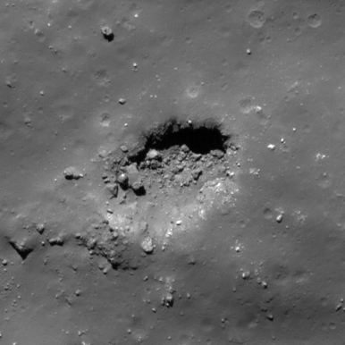 |
|
| Line | 28915 |
| Sample | 1377 |
| Inc. Angle | -42.68 |
| Emission Angle | -0.52 |
| Time | 12.74 |
| Resolution | 0.49 |
| M1118950329R | |
|---|---|
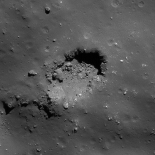 |
|
| Inc. Angle | 46.5 |
| Emission Angle | 0.28 |
| Time | 10.92 |
| Resolution | 0.62 |
| M129369888R | |
|---|---|
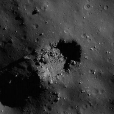 |
|
| Inc. Angle | 65.96 |
| Emission Angle | 0.93 |
| Time | 8.34 |
| Resolution | 0.5 |
| Tycho 17a Stereo |
|---|
 |