Pits Atlas: Tycho 19
| Impact Melt pit: Tycho | |
|---|---|
| Name | Tycho 19 |
| Lat. | -43.0996 |
| Long. | 349.4182 |
| Desc. | Small circular pit on edge of PRF. Possible visible floor in highest-Sun images, or south wall is slightly sloped. There are a couple of probable sub-5m pits a 3-10m S, and a possible ~30m wide collapse of the PRF ~60m NE. There are some more PRFs to the SW, and some subtle depressions arcing from SW to N at distances of ~200, 250, 350m. |
| Types | |
| Terrain | Impact Melt |
| Host Feature | Tycho |
| Funnel Min. Diam. | 14 |
| Funnel Max. Diam. | 15 |
| Inner Min. Diam. | 9 |
| Inner Max. Diam. | 11 |
| Azimuth | 180 |
| Depth | 7.0 |
| Depth 1 | 7.0 |
| Depth 2 | 7.6 |
| Depth 3 | >7.0 |
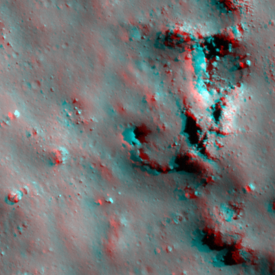
| Best Stereo Left | M1213128685R |
| Best Stereo Right | M1213128685R |
| DTMs | |
| Clipping Width | 200 |
| Other IMGs | |
| Data Warning | |
| Entrance Ramp | N |
| Overhang | ? |
| Nearby Pits? | N? |
| Nearby Fractures? | N |
| Nearby Depressions? | Y |
| In Dome | Y |
| Beside Dome | Y |
| In Depression | N |
| Colinear Pits | N |
| Colinear Depressions | N? |
| Colinear Fractures | N |
| Tycho 19 Shaded Relief | |
|---|---|
 |
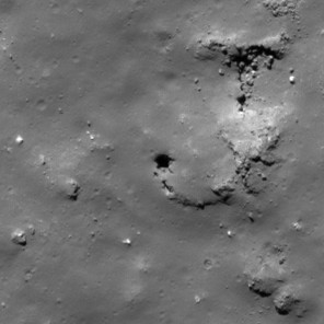
| M185947368L | |
|---|---|
 |
|
| Line | 22791 |
| Sample | 348 |
| Inc. Angle | -45.25 |
| Emission Angle | 3.02 |
| Time | 12.57 |
| Resolution | 0.67 |
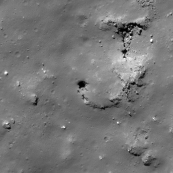
| M1131922380R | |
|---|---|
 |
|
| Inc. Angle | -44.81 |
| Emission Angle | -0.89 |
| Time | 13.23 |
| Resolution | 0.57 |
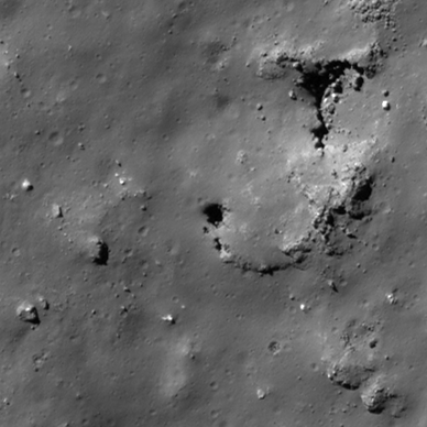
| M152945986L | |
|---|---|
 |
|
| Inc. Angle | -53.09 |
| Emission Angle | 1.76 |
| Time | 14.16 |
| Resolution | 0.48 |
| Tycho 19 Stereo |
|---|
 |