Pits Atlas: Crookes 6
| Impact Melt pit: Crookes | |
|---|---|
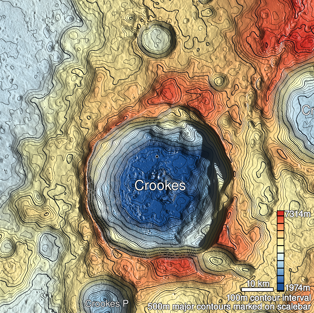
| Name | Crookes 6 |
| Lat. | -10.0854 |
| Long. | 194.8702 |
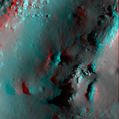
| Desc. | Diamond-shaped pit in the NW side of a NNE-SSW trending ridge (part of a set of at least three such ridges, spaced at ~150m intervals). There is a ~8m boulder filling the NE half of the pit, complicating shadow measurements. No other pits in the area, but there's a possible collapse-caused depression ~35m ESE at the top of the ridge. |
| Types | |
| Terrain | Impact Melt |
| Host Feature | Crookes |
| Funnel Min. Diam. | 20 |
| Funnel Max. Diam. | 28 |
| Inner Min. Diam. | 9 |
| Inner Max. Diam. | 17 |
| Azimuth | 30 |
| Depth | 21.0 |
| Depth 1 | >11.0 |
| Depth 2 | 20.8 |
| Depth 3 | >11.0 |
| Best Stereo Left | M176359843L |
| Best Stereo Right | M176359843L |
| DTMs | |
| Clipping Width | 200 |
| Other IMGs | |
| Data Warning | All measurements are from the W rim. Only Depth 2 is clearly to the floor, but at extremely high Sun (11 degrees) (measure point is at south end of E wall, same place as other depths. Alternate measure at north end is 10m deep) |
| Entrance Ramp | N |
| Overhang | ? |
| Nearby Pits? | N |
| Nearby Fractures? | N |
| Nearby Depressions? | N? |
| In Dome | Y |
| Beside Dome | N |
| In Depression | Y |
| Colinear Pits | N |
| Colinear Depressions | N |
| Colinear Fractures | N |
| Crookes 6 Shaded Relief | |
|---|---|
 |
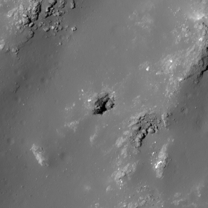
| M169283456L | |
|---|---|
 |
|
| Line | 41462 |
| Sample | 1549 |
| Inc. Angle | -27.26 |
| Emission Angle | 2.27 |
| Time | 13.73 |
| Resolution | 0.43 |
| M1117608455L | |
|---|---|
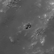 |
|
| Inc. Angle | -11.44 |
| Emission Angle | 2.62 |
| Time | 12.08 |
| Resolution | 0.95 |
| M1191791679L | |
|---|---|
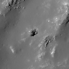 |
|
| Inc. Angle | -31.43 |
| Emission Angle | 0.98 |
| Time | 14.03 |
| Resolution | 0.88 |
| Crookes 6 Stereo |
|---|
 |