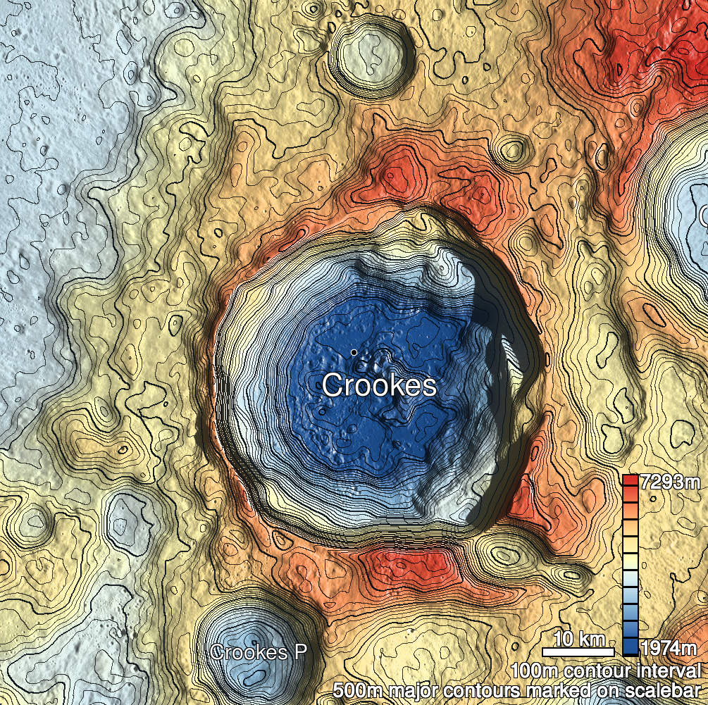
Pits Atlas: Crookes 11a
| Impact Melt pit: Crookes | |
|---|---|
| Name | Crookes 11a |
| Lat. | -10.2353 |
| Long. | 194.783 |
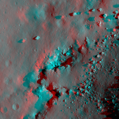
| Desc. | Elliptical pit, northern of a pair of pits ~30m apart at the W base of a PRF. NE wall is a slope to the S end, numerous boulders on the floor (some may have rolled in from the PRF, though there are no tracks). Definitely a possible tunnel across to Crookes 11b, but not provable with orbital images. There are more depressions in a rough line running to the NNE, and Crookes 4 is ~190m NNW. |
| Types | |
| Terrain | Impact Melt |
| Host Feature | Crookes |
| Funnel Min. Diam. | 38 |
| Funnel Max. Diam. | 57 |
| Inner Min. Diam. | 25 |
| Inner Max. Diam. | 41 |
| Azimuth | 45 |
| Depth | 9.0 |
| Depth 1 | 8.4 |
| Depth 2 | 9.7 |
| Depth 3 | 8.0 |
| Best Stereo Left | M176359843R |
| Best Stereo Right | M176359843R |
| DTMs | |
| Clipping Width | 200 |
| Other IMGs | |
| Data Warning | |
| Entrance Ramp | Y |
| Overhang | ? |
| Nearby Pits? | Y |
| Nearby Fractures? | N? |
| Nearby Depressions? | Y |
| In Dome | N |
| Beside Dome | Y |
| In Depression | N |
| Colinear Pits | Y |
| Colinear Depressions | Y? |
| Colinear Fractures | N |
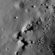
| Crookes 11a Shaded Relief | |
|---|---|
 |
| M1183552745R | |
|---|---|
 |
|
| Line | 31788 |
| Sample | 4525 |
| Inc. Angle | 55.15 |
| Emission Angle | 2.39 |
| Time | 8.36 |
| Resolution | 1.02 |
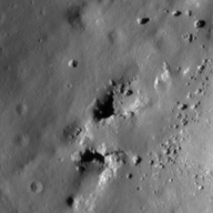
| M1097573241L | |
|---|---|
 |
|
| Inc. Angle | -56.97 |
| Emission Angle | 0.4 |
| Time | 15.78 |
| Resolution | 1.0 |
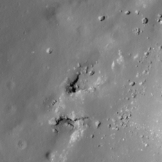
| M1191791679L | |
|---|---|
 |
|
| Inc. Angle | -31.38 |
| Emission Angle | 2.89 |
| Time | 14.02 |
| Resolution | 0.88 |
| Crookes 11a Stereo |
|---|
 |