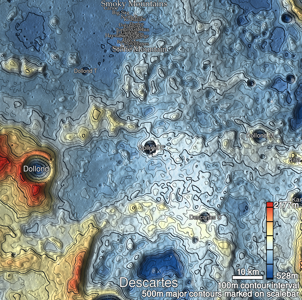
Pits Atlas: Dollond E 1a
| Impact Melt pit: Dollond E | |
|---|---|
| Name | Dollond E 1a |
| Lat. | -10.2737 |
| Long. | 15.7013 |
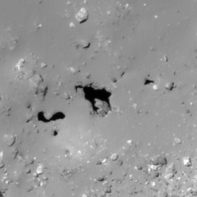
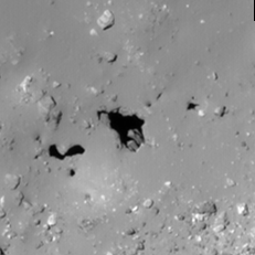
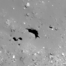
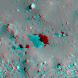
| Desc. | Semicircular pit 200m NW of the crater wall. The west wall appears to slope down at a slightly off-vertical angle, and there are two protruding ~5m boulders/layers at the south end. No floor is visible other than those boulders, so depths are measured to them. Rim-to-rim shadow measures give potential of depths >80m. Slewed image M1208262541L shows none of the same rocks as similarly-lit nadir M1177656184R, but reveals ~50m of illuminated vertical east wall, and a small alcove near the rim. Minimal funnel. Dollond 1b is 25m to the SW. There are a pair of ~4m dark spots that may be collapse features 5 and 10m NE. |
| Types | |
| Terrain | Impact Melt |
| Host Feature | Dollond E |
| Funnel Min. Diam. | 35 |
| Funnel Max. Diam. | 47 |
| Inner Min. Diam. | 25 |
| Inner Max. Diam. | 36 |
| Azimuth | 140 |
| Depth | >50.0 |
| Depth 1 | >43.0 |
| Depth 2 | >45.0 |
| Depth 3 | >58.0 |
| Best Stereo Left | M1121138205R |
| Best Stereo Right | M1121138205R |
| DTMs | |
| Clipping Width | 200 |
| Other IMGs | M1208262541L |
| Data Warning | |
| Entrance Ramp | N |
| Overhang | N? |
| Nearby Pits? | Y |
| Nearby Fractures? | Y |
| Nearby Depressions? | N |
| In Dome | N |
| Beside Dome | Y |
| In Depression | Y? |
| Colinear Pits | Y? |
| Colinear Depressions | N |
| Colinear Fractures | N |
| Dollond E 1a Shaded Relief | |
|---|---|
 |
| M1177656184R | |
|---|---|
 |
|
| Line | 6678 |
| Sample | 1520 |
| Inc. Angle | -19.18 |
| Emission Angle | -0.58 |
| Time | 13.02 |
| Resolution | 0.87 |
| M1101110051L | |
|---|---|
 |
|
| Inc. Angle | -19.45 |
| Emission Angle | 0.31 |
| Time | 13.17 |
| Resolution | 0.92 |
| M1103467217R | |
|---|---|
 |
|
| Inc. Angle | 13.12 |
| Emission Angle | -0.08 |
| Time | 11.36 |
| Resolution | 0.92 |
| Dollond E 1a Stereo |
|---|
 |